
Like many cities in California, San Francisco finds itself in a paradox: It faces an equally high risk of drought and extreme precipitation.
The San Francisco Bay watershed has been in drought more than 60% of the time since 2000. In that same timeframe, the city experienced several extreme precipitation events in which the rainfall exceeded 0.88 inches in a two-day span.
In fact, the most notable event occurred on New Year’s Eve in 2022, when approximately 5.46 inches of rain fell in a 24-hour period. This resulted in the second-highest rainfall total for San Francisco on record.
It’s easy to wonder: How is it possible for San Franciscans to experience both weather extremes at any given time? Put briefly, it’s due to a phenomenon that occurs along the west coast of the U.S. known as “rivers in the sky.”
What is an atmospheric river?
California’s skybound rivers, technically called atmospheric rivers, are long, narrow regions in the atmosphere that transport water vapor out of the tropics. They’re called “rivers in the sky” because the average stream of an atmospheric river carries twice the amount of water as the Amazon River.
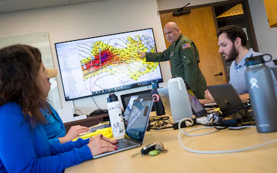
This large volume of water creates both opportunity and risk. Atmospheric rivers can be hazardous, yet they are essential for many Californians to have a fresh water supply. Anna Wilson, assistant director for Atmospheric River Reconnaissance with the Center for Western Weather and Water Extremes at the Scripps Institution of Oceanography. | Photo by Scripps Institute of Oceanography
“Without atmospheric rivers we’re in a drought,” said Anna Wilson, assistant director for Atmospheric River Reconnaissance with the Center for Western Weather and Water Extremes at the Scripps Institution of Oceanography. “We need them, but the extreme ones are challenging to manage.”
Atmospheric rivers provide up to half the annual precipitation on the U.S. west coast. So while they’re prone to causing mudslides, flooding, and other natural disasters, Californians rely on atmospheric rivers as a water source during times of drought. In light of this, researchers are attempting to reduce these risks by improving forecasts through computer modeling and other forecasting technologies.
“We’re trying to get a sense of how big the impacts will be,” Wilson said. “Before we even forecast the rainfall, we want to know how much water and wind are coming at us, and how long the storm will last at any given point.”
Forecasting atmospheric rivers and measuring their magnitude
While atmospheric rivers aren’t necessarily difficult to track, they are challenging to forecast.
“It’s hard to tell where atmospheric rivers will have the most impact,” Wilson said. “You can see them on satellites, but knowing how they’re going to behave is a totally different thing.”
As a result, Wilson’s team has focused their efforts on forecasting atmospheric rivers to better enable experts to take advantage of their benefits and mitigate their negative impacts.
“We have a group in our center who's doing a lot with AI and machine learning to assess how different tools can help us,” she said. “We also have a precipitation science team that is trying to develop a better understanding of how atmospheric rivers form so we can better represent them in traditional models.”
One of these projects is the AR rating system. Created in 2019, Wilson’s team created a rating scale to characterize the strength and impacts of atmospheric rivers so city officials can adequately prepare. Unlike other storm scales that focus on damage, the AR scale accounts for potential benefits to water supply as well. It has five scale ranks:
- AR 1 (weak): Mostly beneficial.
- AR 2 (moderate): Mostly beneficial, but slightly hazardous.
- AR 3 (strong): A balance of beneficial and hazardous.
- AR 4 (extreme): Mostly hazardous, but slightly beneficial.
- AR 5 (exceptional): Mostly hazardous.
San Francisco is one of the first cities to utilize the scale. City officials have used AR forecasts to assess flood potential before an atmospheric river hits so they can better prepare for the aftermath.
Preparing for and reducing the impact of an atmospheric river
Understanding when an atmospheric river will hit and how severe it will be is only half the battle. Cities also need infrastructure that can effectively handle a sudden influx of water.
San Francisco is leading the charge on these efforts in California. The city has invested in several green infrastructure projects and reuse efforts that reduce the amount of stormwater entering its sewer system from atmospheric rivers. This helps minimize flooding across the city and prevent pollutants from reaching the ocean while also beautifying city streets and community spaces.
There are four common types of green infrastructure and water reuse projects happening across the city:
- Rain gardens. These short, shallow basins have collected more than 10 million gallons of stormwater across San Francisco. Approximately 143 San Franciscans have participated in the city’s Rain Guardians program to maintain its 100+ water gardens.
- Permeable pavement. Seventeen of San Francisco’s streets prevent water runoff by being permeable. This means they absorb some water into the underlying levels of gravel and soil, helping filter out water pollutants and keeping local waterways clean. One particular project on Holloway Avenue reduced the volume of stormwater entering the sewer system by 77% and 78% percent.
- Curb extensions. San Francisco has provided pedestrians with extra space in 43 crosswalks across the city by installing permeable surfaces and rain gardens at each one.
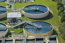
- Managed aquifer recharge. San Francisco and other nearby cities are holding stormwater in underground aquifers and using it to recharge groundwater instead of holding it in an above-ground reservoir. This improves water quality, prevents saltwater intrusion, and builds water supply for drought. Wilson notes this is an effective way Californians reuse the water from atmospheric rivers.
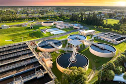
To date, these water conservation projects have helped recharge groundwater, reduce wastewater treatment costs, and improve air quality across San Francisco.
By the end of 2024, about 470 green infrastructure projects and reuse efforts captured nearly 290 million gallons of water. With a goal of capturing 1 billion gallons by 2050, these efforts have helped San Francisco reach more than a quarter of its goal with 25 years left to meet it.
Other California cities can take a similar approach to water reuse and conservation. The AR rating scale is available to help city officials prepare for an atmospheric river, and San Francisco’s green infrastructure projects can be replicated at different scales and budgets.